 |
| The Marble Caves / Las Cuevas de Marmol |
A week ago, I took a brief journey with my good friend Jackie to part of Northern Patagonia in Chile. I realize I haven't always written summaries of my trips and that's a shame. I'll have to remember to do this more often as it's fun to have it written down.
This trip consisted of a drive across various small towns as well as experiencing how the people there celebrate the Fiestas Patrias (the Chilean independence holidays), a boat trip to the fabled Marble Caves, and lots of traveling across beautiful rivers, valleys, and mountains with waterfall after waterfall. It was a great journey and my first time in these parts of Chile. In this blog post, I'll briefly recount the adventures we had, both to keep it as a memory and to perhaps help future travelers thinking of visiting Southern Chile.
As always, the pictures can be clicked to see larger versions.
The Journey There
The first thing to note about our journey was that it was done in the off-season. Tourists who visit Patagonia tend to do so in, or close to, the summer months (Dec-Mar, or so). The weather is better in that time of year, though rain is frequent all year round. Places to stay at are also more likely to be open, though they may also be full if many travelers are present. By traveling in the off-season, we didn't see too many other travelers and in fact found some places closed still. Nevertheless, we managed. My friend Jackie had done a similar trip back in the summer, so for her it was a chance to see some of the same places in a completely different season. Part of the trip, however, was new for her (and entirely new for me).
Our first 'setback' was the fact that we flew to Coyhaique to start our adventure, but didn't realize until we landed that the airport there is actually in the town of Balmaceda, about 45 minutes south of Coyhaique. We had been counting on being close to Coyhaique to fill up our rental car with gas and get some supplies. However, the vehicle was turned over to us with a full tank so we felt it was fine to go on from there rather than back track to Coyhaique. We kept worrying about the gas, though, since it seemed to be dropping faster than we had anticipated on the way to Villa Cerro Castillo. However, it turned out OK as it must have been because we were going uphill and we were eventually able to refill at Puerto Rio Tranquilo before the tank even reached half.
 |
| Cerro Castillo |
One of the things of traveling at the time we did is that we were so close to Winter. September is the start of Spring for Chile so the mountains were still mainly covered with snow and rain was much more frequent. The snow on the mountains made identifying hanging glaciers (an abundant sight in Patagonia) far more difficult. Fortunately, the weather on our first few days was excellent. When we reached Villa Cerro Castillo we were treated to amazingly clear views of Cerro Castillo itself, something that is a rarity even during peak season (see picture above).
 |
| Lago General Carrera, near Puerto Murta |
Our first day ended in Puerto Murta, a small town of about 500 people near the Lago General Carrera. This lake is the largest in Chile and second largest in South America. It is beautifully blue, but the best views we had of it was on the next day. We had no pre-arranged place to stay as most of the places we had asked said they weren't open yet. Still, we went to the general store and asked there and the lady called up her friend who happened to have a place ready. This was a nice little hostel, but we were the only guests and the first in the season too. Jackie had warned me about the likelihood of camping out and I fully expected to rough it out for most of the trip. I was overjoyed to be able to sleep in an actual bed and away from the drizzle that started in the afternoon!
Lake General Carrera
The following day we set off for Puerto Sanchez, an even smaller town south of Murta across a narrow mountain pass. This town was so different from Murta we both had to do a double-take. The houses looked far better maintained and of much higher quality, and the tiny airport apparently was in use as opposed to the one in Murta. Clearly, Sanchez had benefited from the nearby copper mines and enriched itself. We're not sure if the mining is still on going, but we were told the one we could see near town was abandoned.
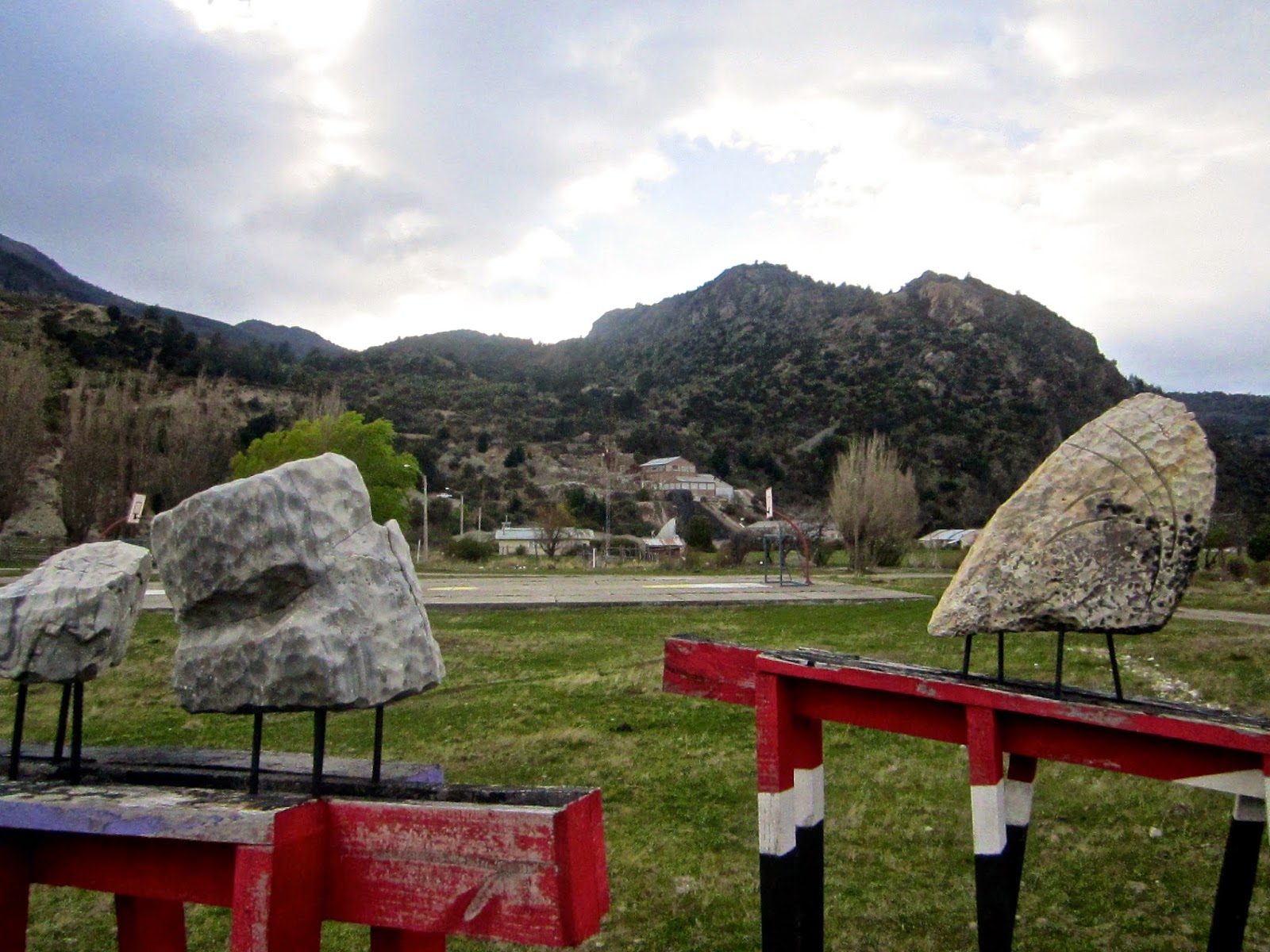 |
| Some marble rocks and an abandoned mine in the distance at Puerto Sanchez |
The reason we went to Sanchez was the main reason for the trip: the Caves of Marble. These are present in at least two places in the Lago General Carrera: at the famous Marble Cathedral near Puerto Rio Tranquilo and at the Panichini islands near Puerto Sanchez. We took a boat ride with Luis Alarcon (lualo1[at]hotmail.com), one of at least two people in town that do the boat tours to the caves. We had arranged with him beforehand via email, but had been unable to reach him in the days prior to our trip. We simply showed up in town, asked a local where Luis was and showed up in his home. Crazy, but that's how things worked out in such a small town where everyone knows each other.
 |
| Heading to the islands and the caves beneath them |
The weather, though not as good as the prior day, was still in our favor so we got the chance to travel by boat to the islands. This was about an hour-long trip where Luis told us about the cave and mineralogy. During our Spring-time visit, the water level is at its lowest and shimmers a turquoise color. In summer, the water levels are higher and the caves are surrounded by deep blue waters. These caves were absolutely impressive and highly recommended for any trip near the Lake. Curiously, the islands are privately own and not protected as part of a national park. As such, the owners could very well choose to mine the islands instead of allowing visitors to see the caves. We can only hope that these islands will remain untouched so as to showcase this natural wonder.
 |
| The Marble Caves in Chile |
After the visit to the caves, we back tracked out of Sanchez and Murta to continue along the road to Puerto Rio Tranquilo and our final destination for the day: Cochrane. At Puerto Rio Tranquilo we stopped for gas relieving us of our gas-worries. It seems that only Coyhaique, Cochrane, and Rio Tranquilo have gas stations so bear that in mind if you choose to do a similar trip. After the brief stop at Rio Tranquilo, we stopped for lunch near the lake (see pic below). The lake's colors were amazing, as was the back drop of snowy mountains. My picture does not do it justice.
 |
| Lake General Carrera |
A cool little attraction on the lake was the orange bridge passing over a small section of it where Lake General Carrera flows into Lake Bertrand. We stopped here for plenty of pictures. Interestingly, all (or at least the ones we saw) bridges in Chile are orange. Beyond the bridge and further along the road we reached an intersection that marked the limits of Jackie's prior trip. Taking it left would have taken us towards Puerto Guadal, Chile Chico, and onwards into Argentina. Our plan, however, was different. We took the fork right towards Puerto Bertrand and Cochrane into lands unexplored by either of us.
 |
| Puente Desagüe Lago General Carrera |
Following Rio Baker
After the fork we got some nice views of Lake Bertrand and the Rio Baker. Rio Baker is the largest river, by volume, in Chile and it was absolutely impressive. This river is fed by Lake Bertrand, which itself is fed by Lake General Carrera, which itself is fed by glaciers. The glaciers give these lakes and rivers an incredible turquoise blue-green color. We saw many amazing things in our journey south and Rio Baker was one of the unexpected highlights.
 |
| Rio Baker |
Rio Baker, however, is the home of the controversial HydroAysen project. This project proposes to construct, among other things, 5 hydroelectric dams, two of which would be located along the Rio Baker. The map on their website shows the exact locations. This would generate a lot of clean power and develop the region, but at the expense of the natural beauty of the river and surrounding areas. Many people in Chile, not just those in Patagonia, are opposed to the project. Along the way, we saw many hand-made signs or graffiti proclaiming "Patagonia Sin Represas" (Patagonia Without Dams). I understand the need for power and applaud their considering clean energy alternatives, but its a shame that such a beautiful river valley would be destroyed. We'll have to see over the next few years what happens with this project.
 |
| Rio Baker, near the confluence with Rios Neff and Maiten |
We reached Cochrane some time later. It should be noted that the roads along this stretch of the Carretera Austral are not paved and so one moves much slower. Easily 3 or 4 hours can pass between major towns. Hence, the need for a full tank of gas for nearly any excursion or trip. Cochrane was the largest town we had visited yet. It was a big change from our prior night.
We stayed at the Cabanas Sol y Luna, a positively luxurious cabin. This was the nicest place we stayed at and I loved it. The owner also brews her own beer (Baker Beer) so you can ask for some when you get in. We got the two she had at hand: a dark Bock and a Belgian ale. I don't know too much about beer, but I liked the Belgian variety.
 |
| The fonda at Cochrane |
The beer was had later in the evening though, as beforehand we set off to find the local fonda. A fonda is the typical Chilean party celebrating independence day (Sep. 18th). They usually last several days and there was one when we arrived (Sep 17th). As we expected, it was much much smaller than those in Santiago. About twenty or so people were there while we were around. It's possible more showed up later in the evening as it was scheduled to go on until 4 or 5 am. We had some of the usual treats like terremotos (a drink) and anticuchos (meat skewers). We also learned about a game that is quite popular in the South and is actually of Argentinian origin (or at least more commonly practiced there): la taba. It consists of throwing a metal piece (apparently it's traditionally a bone) that is longer on one side towards some mud on the opposite end. If it lands short-side up, you win the toss and collect some money. If it doesn't you put down some money, usually a 100 peso coin. This goes back and forth between two mud rectangles and a bunch of people gathered to watch the men toss the piece back and forth. We saw the same setup in the other places we visited, but didn't see anyone playing at those times.
 |
| A close up of the taba game |
Caleta Tortel: The End of our Road
The following day we woke up to rain. We had been talking about checking out the Reserva Nacional Tamango, which was very close, but the rain made that difficult. Any hikes would have been miserable and the rain and clouds would have hidden the views. Instead, we decided to head out towards our final destination: Caleta Tortel.
 |
| A waterfall on the way to Caleta Tortel |
The road to Tortel took us across valleys where we saw waterfalls to our left and right. We stopped at a really nice one that was just by the road (see picture above). After a while we reached a fork in the road that one can take to head farther South into Puerto Yunguay, where one can take a ferry to head to Villa O'Higgins: the very end of the Carretera Austral in Chile. Instead, however, we continued on the road towards Tortel, a tiny village of 507 people (as of the 2012 census) that lives primarily on logging the cypress trees in the region, as well as from tourism.
 |
| Entering Caleta Tortel |
An interesting aspect of Caleta Tortel is that there are no roads. One parks the car at the top of the hill in town and then descends to the town itself on wooden platforms and walkways. There are 7.5 kilometers of walkways constructed from the local cypress trees. It makes the village quite unique and offers amazing views of the bay and the surrounding fjords. Caleta Tortel itself is named after a naval commander (Juan José Tortel Maschet), similar to Chochrane (Lord Thomas Cochrane).
 |
| Caleta Tortel |
The Journey Back
The day after, the 19th of September, we started our journey back. We needed to be close to the airport as our flight would leave early on the 20th and we needed to return the vehicle with a full tank of gas. Curiously, that day dawned without rain and we got to see Caleta Tortel at sunrise. There were still clouds, but patches of blue sky would peak through from time to time. On our journey north, these patches grew less and we went back to the rain.
We did stop along the way, but less so than on our trip South and so we made very good time. We had worried that we would just barely make it to Villa Cerro Castillo at nightfall, but as the day progressed we realized we would no trouble to reach Coyhaique in the evening. We even took a detour to check out the 'glacier road' as Jackie called it. This is the road towards Bahia Exploradores, which you take off of Rio Tranquilo. It takes you through a valley where you can see hanging glaciers on each side. Unfortunately, there was snow on the mountain tops which made distinguishing glaciers and snow very difficult. Still, it was a nice detour and we got to see plenty of waterfalls.
 |
| A valley on the road to Bahia Exploradores |
After Cerro Castillo, which we could not see due to low clouds, we were given a real treat. The road takes us through the Reserva Nacional Cerro Castillo and climbs up quite high, high enough that rain becomes snow. This stretch of road was covered with snow and even more was falling. It was a winter wonderland of trees covered in snow, rivers carving passage in the snow, and more snow piled up on the side of the road. I don't have a lot of experience with snow so I was very excited. We even made a tiny snowman!
 |
| A snowy river on the road to Coyhaique |
At Coyhaique, we spent the night at a cabin in town and had a nice dinner in one of the few places that were open on the 19th. It was raining yet again, but we were really only there to spend the night. The following day we took a brief look at the town from the nearby hill, but then went off to the airport and our ride home.
Final Thoughts
This was a great journey to Patagonia. I had never been so far south in Chile before so this was my first time seeing the landscape. I usually don't do too much trekking or camping or rough trips of that kind, but every so often I feel motivated to do so. Traveling with Jackie was fun as she has a far more adventurous spirit than I do and that can serve as excellent motivation to try out these exciting trips.
It's difficult to say what the number one thing was for this trip as I feel that there were so many cool things I saw. Our first goal was the Marble Caves and they certainly did not disappoint. I'm glad we had good weather for that. Caleta Tortel was our other main goal and it was indeed a cute little town. The Fiestas Patrias in the small towns of Patagonia are similar enough to those elsewhere (in terms of food, music, etc), though with far less people. It did seem that perhaps families would op for a private asado of their own than go to the fiestas.
The Rio Baker was an amazing river and I don't think either of us really expected that. It was so cool that we got to see the lakes that feed the river all they way to its mouth (Caleta Tortel). The colors in the waters of the lakes and rivers in Patagonia are incredible. On the journey back, the winter wonderland we passed through was also pretty neat and an unexpected surprise.
Overall, I had a great time in our trip and I'm glad we made it. I would encourage anyone to check out the southern regions of Chile if you happen to be nearby. Development is continuing in these regions so very soon these may no longer be pristine regions to explore.
No comments:
Post a Comment
Note: Only a member of this blog may post a comment.